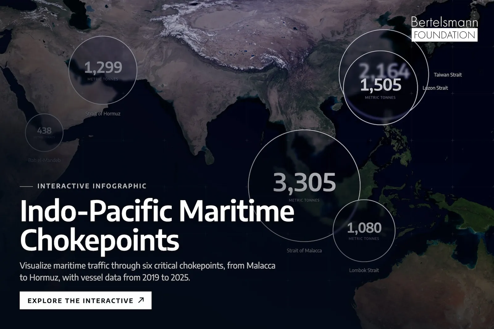
Indo-Pacific Maritime Chokepoints, interactive map of vessel traffic through six straits from Hormuz to the Taiwan Strait: Indo-Pacific Maritime Chokepoints

Three infographics for the Indo-Pacific Nexus, two of them interactive maps and charts built to embed.
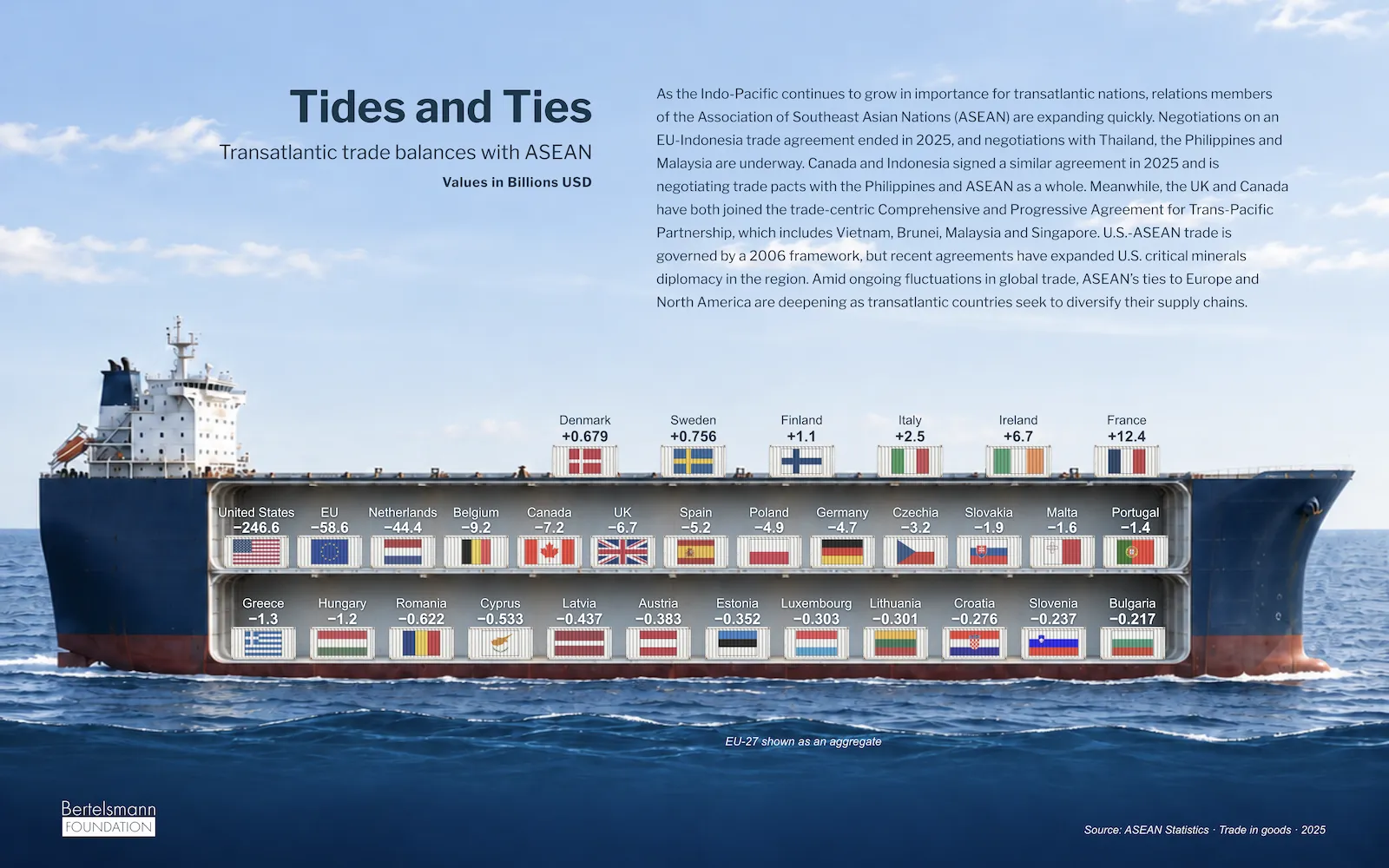
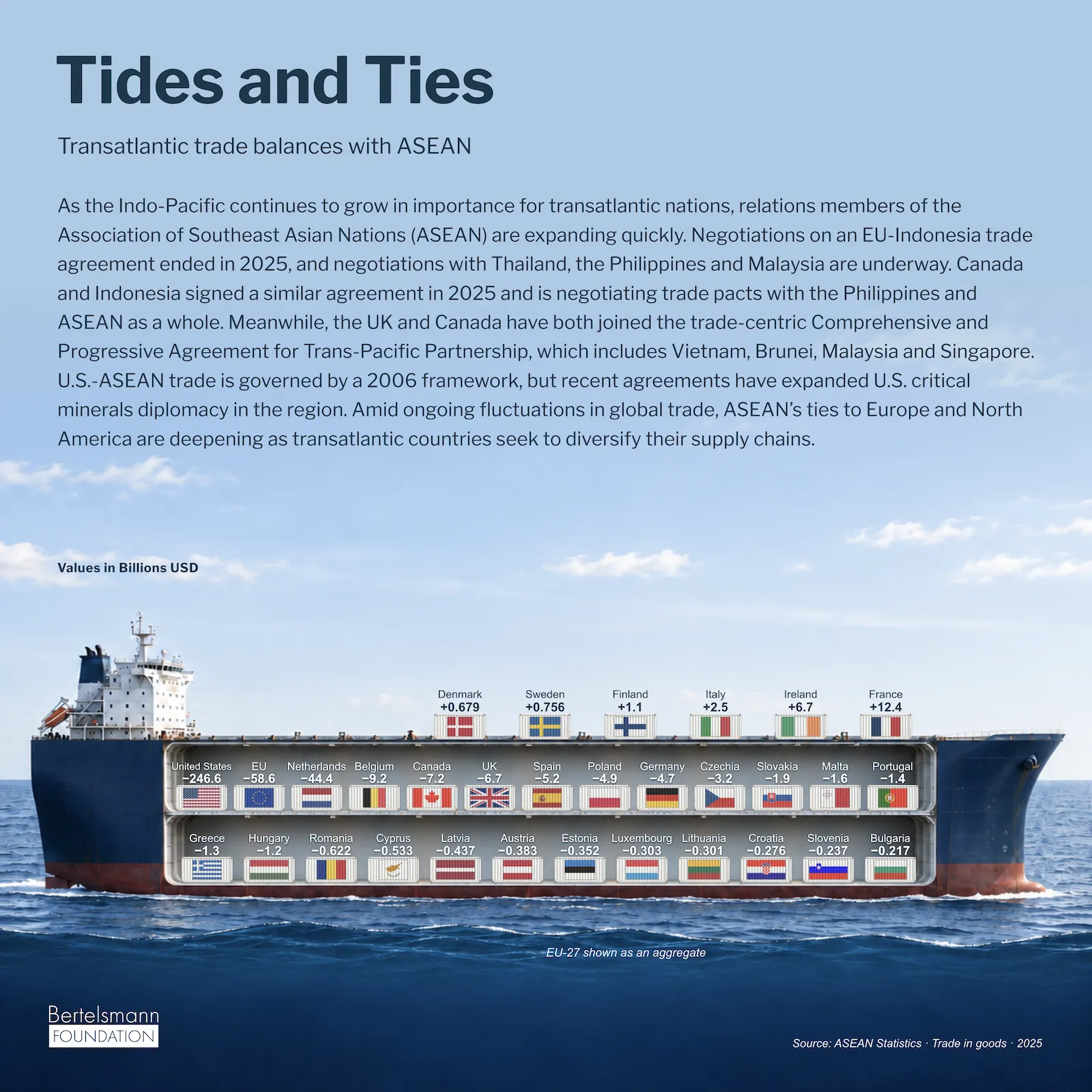
Tides and Ties, transatlantic trade balances with ASEAN drawn as flags in the hold of a container ship: Tides and Ties, landscape
Tides and Ties, square version for social media: Tides and Ties, square
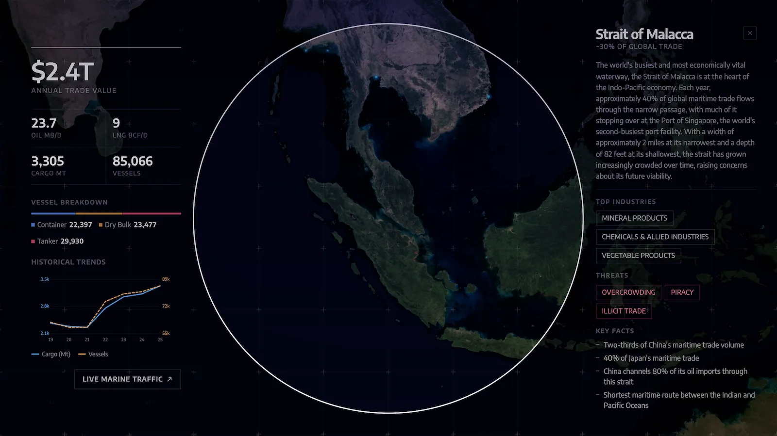
Strait of Malacca detail view with trade value, cargo, vessel breakdown and historical trends: Strait of Malacca detail
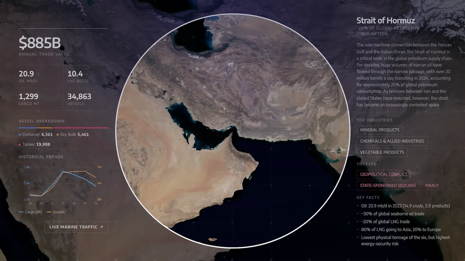
Strait of Hormuz detail view with trade value, cargo, vessel breakdown and historical trends: Strait of Hormuz detail
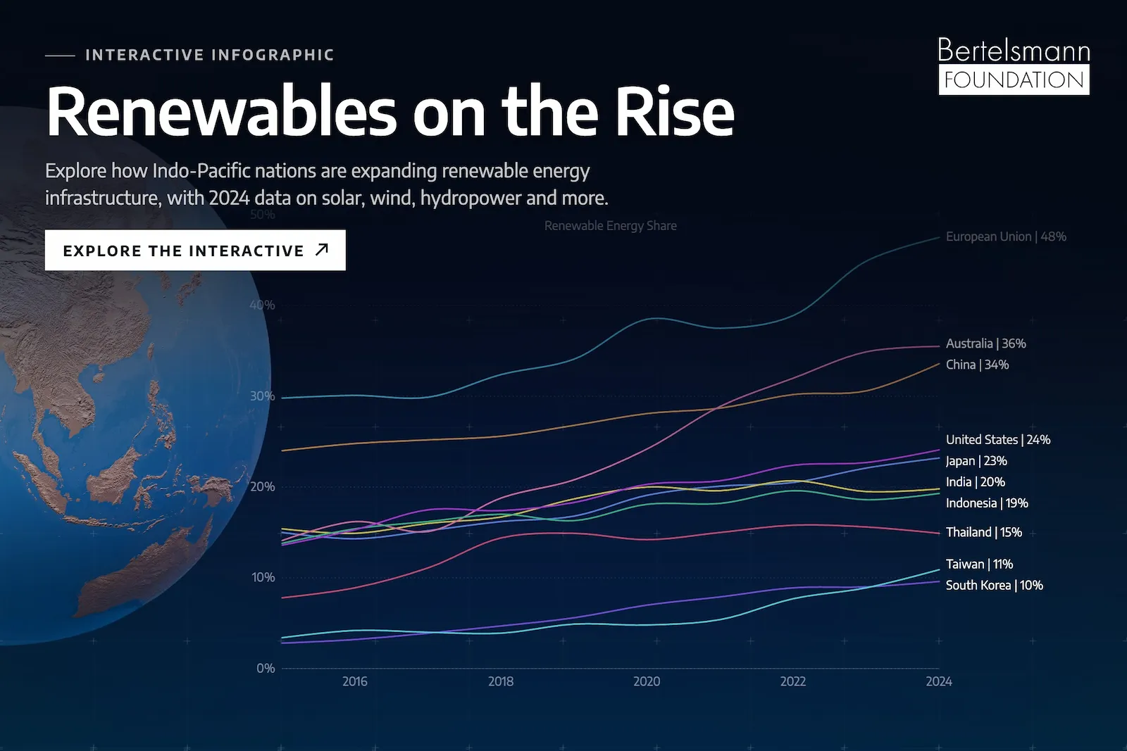
Renewables on the Rise, line chart of renewable energy share from 2015 to 2024 for Indo-Pacific economies, the U.S. and the EU: Renewables on the Rise